Flight Simulator X: Preparation for landing Mooney Bravo
We continue flying that heading until we are about 50 nm from the VOR. Then again we switch the autopilot to NAV mode. Approximately 33 nm away from the VLM VOR we are given instructions for the approach. In our case the controller says we are 69 nm east of the airport, we are to turn right to heading 305 and expect vectors for ILS approach to runway 31.
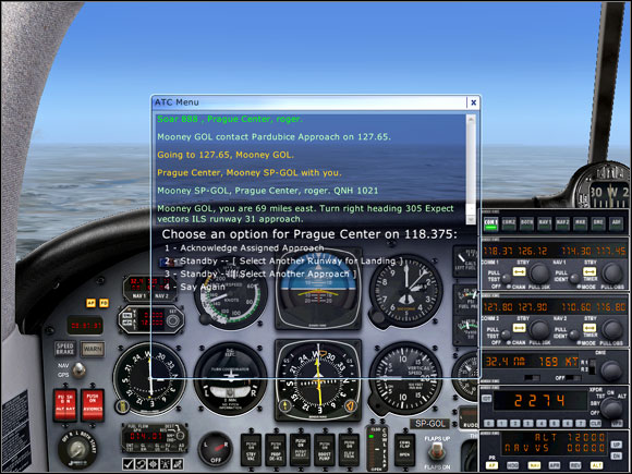
Now we can choose:
1 - Acknowledgement of the specified approach;
2 - Change of landing runway;
3 - Change of type of approach, ex. a visual approach.
We choose our assigned approach and turn right to heading 305. After a while we are instructed to descend to 4000 feet.
We set the autopilot ALT to 4000, making no changes to the vertical speed. During the descent we have to remember about thrust reduction to avoid too high speed. When we cross the altitude of 10000 feet, we switch on the taxiing and landing lights as well as set the altimeter to local QNH pressure - in our case it's 1021 hPa, i.e. 30.15 inHG.
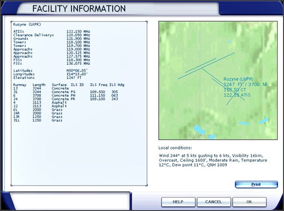
In the meantime we can have look at the airport chart. The ILS frequency for runway 31 is 109.500 and the runway heading is 305 degrees.
Soon we receive an instruction to change frequency to 124.675 and contact Kbely Approach. The new station redirects us to heading 215.
As we are to be vectored to the final approach to runway 31, we can switch the NAV1 radio to ILS frequency (109.50) and set the new course to 305.
When we are about 19 miles from the airport, we receive further instructions to turn right to 275 degrees, descend and maintain 4000 feet (we should already have reached that altitude by now) and permission for ILS approach to runway 31 with maintaining 4000 feet until we are established on the localizer (the radial of runway 31). Now we have to contact Ruzyne Tower on frequency 119.700.
Note, that approach permission does not mean landing permission!
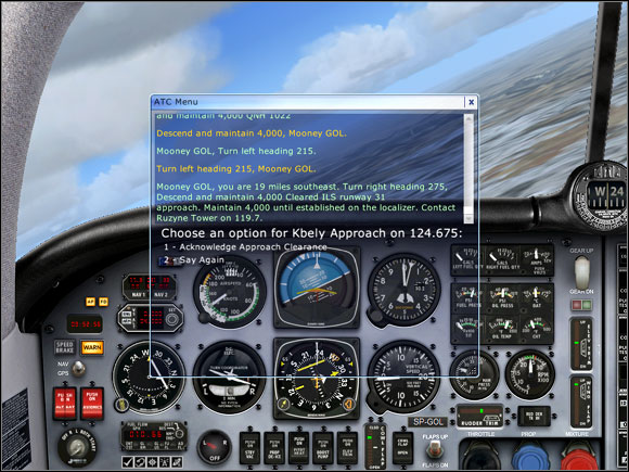
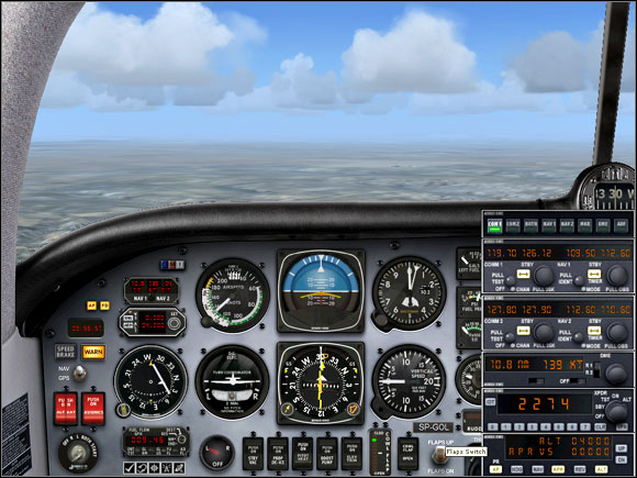
As we can see on the picture above, the course arrow sections do not form a solid line. The middle section is moved to the left, which means our aircraft is localized to the right of the localizer. We should keep flying at heading 275 to make the course arrow solid.
After establishing on the localizer we can set the autopilot to NAV mode, which will hold us on the localizer while closing to the glideslope. When two yellow triangles on both sides of the HSI (Horizontal Situation Indicator) start to go down, we can press the APP button on the autopilot panel which will keep us right on the correct path.
The glidepath can be compared to an incline that leads the aircraft toward the runway threshold.
While descending we should reduce thrust to maintain speed of 120 knots.
- Flight Simulator X Game Guide
- Flight Simulator X: Game Guide
- Flight Simulator X: Mooney Bravo
- Flight Simulator X: Cockpit Mooney Bravo
- Flight Simulator X: Cruise Mooney Bravo
- Flight Simulator X: In the aircraft ... Mooney Bravo
- Flight Simulator X: Time for the engine start-up Mooney Bravo
- Flight Simulator X: Taxiing Mooney Bravo
- Flight Simulator X: Time to go up Mooney Bravo
- Flight Simulator X: Flight Mooney Bravo
- Flight Simulator X: Preparation for landing Mooney Bravo
- Flight Simulator X: Landing Mooney Bravo
- Flight Simulator X: Taxiing to stand, parking Mooney Bravo
- Flight Simulator X: Mooney Bravo
- Flight Simulator X: Game Guide
You are not permitted to copy any image, text or info from this page. This site is not associated with and/or endorsed by the developers and the publishers. All logos and images are copyrighted by their respective owners.
Copyright © 2000 - 2025 Webedia Polska SA for gamepressure.com, unofficial game guides, walkthroughs, secrets, game tips, maps & strategies for top games.
